
Garmin eTrex SE
4.2Editor score
Automatic Geocaching Live updates
Multi-GNSS satellite support
Up to 1,800-hour expedition mode
IPX7 water-resistant construction
A handheld GPS for geocaching should provide dependable positioning, readable mapping, useful navigation sensors, and enough endurance to reach a cache beyond the end of a trailhead. It must also suit the way you explore, whether that means lightweight hiking, precise field navigation, wireless cache updates, or documenting coordinates and photographs.
This guide compares ten Garmin handhelds using the supplied specifications, ratings, feature descriptions, and renewal status. We examine display size and readability, mapping resources, multi-GNSS positioning, compass and altimeter support, waterproofing, memory, connectivity, batteries, cameras, and dedicated geocaching functions.
Each review identifies the strongest use case and important compromises, while the top picks highlight the most balanced, budget-conscious, and premium options. Product availability and prices can change, so confirm the current listing, included accessories, map coverage, and battery configuration before purchasing.
4.2Editor score

4.3Editor score

4.1Editor score
As an Amazon Associate we earn from qualifying purchases.
The comparison below covers all ten handhelds, highlighting the differences in mapping, satellite support, navigation hardware, power options, and field-oriented features that matter most during a geocaching trip.






The Garmin eTrex 22x combines a compact enclosure, readable color display, dependable satellite positioning, and preloaded topographic maps. Its 4.3 rating reflects a balanced package that handles both route finding and coordinate-based geocaching without the complexity of a touchscreen handheld. The 2.2-inch screen offers 240 by 320 pixels and is designed for sunlight visibility.
We may earn a commission when you buy through this link, at no additional cost to you.
Topo Active maps include routable roads and trails for hiking and cycling, reducing the need for manual map preparation on many trips. Support for both GPS and GLONASS can improve tracking in challenging terrain, while eight gigabytes of internal memory provides room for additional map downloads. A microSD card slot further expands storage when more regional detail is required.
The main limitation is that this model does not include the three-axis compass or barometric altimeter found on the eTrex 32x. The eTrex 22x also lacks the wireless cache updating, wide color touchscreen, and integrated camera features available on higher-end devices. These omissions matter most for hikers who need a fixed heading, precise elevation reference, or rapid cache synchronization.
Despite those trade-offs, the eTrex 22x is a strong general recommendation for walkers, hikers, and beginning geocachers who value portability, straightforward controls, preloaded maps, and dependable AA-battery operation. It is especially suitable for users who can manage navigation through the standard GPS and map functions without demanding advanced sensors or frequent wireless updates.
The eTrex 22x favors familiar physical navigation over app-style complexity. Its sunlight-readable color display, topographic basemap, and route guidance make it effective for following trails, locating saved waypoints, and working from coordinates when cell service is unavailable.
Preloaded Topo Active maps cover common outdoor navigation needs, while eight gigabytes of internal memory and a microSD slot allow users to prepare additional map regions. Offline storage is especially valuable for geocaching routes through remote areas.
We may earn a commission when you buy through this link, at no additional cost to you.
The Garmin eTrex SE stands out as the most geocaching-focused model in this group. Its 4.2 rating reflects a capable 2.2-inch high-resolution display, multi-GNSS reception, wireless smartphone integration, and automatic Geocaching Live updates. Those cache functions can provide descriptions, logs, and hints without requiring manual data entry at the trailhead.
We may earn a commission when you buy through this link, at no additional cost to you.
Compatibility with the Garmin Explore app adds wireless software updates, trip planning, active weather information, and smart notifications. Multi-GNSS support encompasses GPS, GLONASS, Galileo, BeiDou, and QZSS, giving the unit access to several satellite systems for potentially better positioning in demanding environments. A digital compass also provides a heading while stationary.
Its most striking advantage is power flexibility. The specifications list up to 168 hours in standard mode and up to 1,800 hours in expedition mode using two replaceable AA batteries. That makes it compelling for long expeditions, but the batteries are not included. It also lacks an integrated camera and a barometric altimeter, so it is less suited to photo documentation or weather-related elevation tracking.
The eTrex SE is a sensible budget recommendation for hikers and geocachers who want live cache details and very long battery endurance without moving to a larger touchscreen model. It is particularly useful for users comfortable pairing the handheld with a compatible smartphone before heading into areas without cellular coverage.
Automatic Geocaching Live updates can deliver cache descriptions, logs, and hints when the unit is paired through the Garmin Explore app. Preparing these details in advance keeps the handheld focused on navigation once the route is underway.
The eTrex SE supports up to 1,800 hours in expedition mode and up to 168 hours in standard mode. Field-replaceable AA batteries make it practical for long trips, although users should confirm their preferred battery type and carry spares.
We may earn a commission when you buy through this link, at no additional cost to you.
The renewed Garmin GPSMAP 66s is a large-screen handheld aimed at hikers who want detailed navigation and wireless field services. It earns a 4.0 rating and centers on a 3-inch sunlight-readable color display, multi-GNSS support, a three-axis compass, and a barometric altimeter. Those features provide a more complete navigation package than the compact eTrex models.
We may earn a commission when you buy through this link, at no additional cost to you.
BirdsEye Satellite Imagery can be downloaded directly to the device without a stated annual subscription, while preloaded TOPO maps cover the United States and Canada. Expanded wireless connectivity supports active weather forecasts, animated radar, and Geocaching Live synchronization. This makes the unit more versatile when preparing caches and checking conditions before losing cellular service.
The important caveat is its renewed status. Buyers should examine the device carefully for cosmetic wear, verify that the screen, controls, compass, altimeter, ports, and battery compartment work as expected, and confirm what accessories are included. It also lacks an integrated camera, so geocachers who routinely document finds must carry a separate camera.
Despite the renewal consideration, the GPSMAP 66s is the best premium pick in this list for users who prioritize a large display, downloadable imagery, elevation tools, and wireless services. It is better suited to route-heavy hiking and geocaching trips than to travelers seeking the smallest possible handheld.
The 3-inch color display gives topographic details and downloaded imagery more room than the 2.2-inch eTrex screens. This is helpful when following complicated trails, inspecting surrounding terrain, or navigating through dense waypoint sequences.
Wireless connectivity brings active forecasts, animated weather radar, and Geocaching Live updates to the handheld. Preparing these resources before travel gives users useful context even where cellular service is unavailable.
We may earn a commission when you buy through this link, at no additional cost to you.
The Garmin eTrex 10 is a straightforward worldwide navigator with a 4.3 rating. Its rugged 2.2-inch monochrome display, physical controls, and preloaded worldwide basemap make it approachable for geocachers who want dependable coordinate and route navigation without a large interface or complex feature set.
We may earn a commission when you buy through this link, at no additional cost to you.
The WAAS-enabled receiver includes HotFix and GLONASS support for positioning performance, while the IPX7 rating protects against splashes and rain. Paperless geocaching support is a direct benefit for modern waypoint-based caches. The unit can also record waypoints, identify elevation points, and store tracks for estimating distance and time between points.
Its monochrome display is less detailed than the color screens found on newer eTrex devices, and the listed 20-hour battery life is shorter than several alternatives. It also does not provide the automatic Geocaching Live updates or smartphone connectivity of the eTrex SE. Users who require rich topographic colors, downloadable imagery, or a digital compass may find newer models more flexible.
The eTrex 10 remains a good recommendation for travelers who cross regions and value a worldwide basemap, paperless caching, robust construction, and simple physical operation. It works especially well for users who already understand Garmin navigation and prefer a compact monochrome screen over touch controls.
A preloaded worldwide basemap reduces the need to load a regional map before every trip. That convenience is useful for geocachers who travel between countries, although the monochrome display presents less visual detail than color alternatives.
Native paperless geocaching support lets the handheld hold and navigate cache information. The two-AA battery design also provides a familiar serviceable power option for remote trips.
We may earn a commission when you buy through this link, at no additional cost to you.
This rugged handheld GPS differentiates itself with a 3.2-inch sunlight-readable display, physical buttons, multi-GNSS support, and a rechargeable battery rated for up to 36 hours. Its 3.9 rating is the second-lowest in the group, but the supplied specification presents a capable combination of display size, storage, sensors, and power.
We may earn a commission when you buy through this link, at no additional cost to you.
The unit supports GPS, Galileo, BeiDou, and QZSS, with a stated location precision within six feet. A three-axis compass and barometric altimeter support navigation and elevation tracking, while preloaded USA topographic maps cover common hiking and camping areas. Thirty-two gigabytes of internal memory provides meaningful room for additional downloaded maps.
The physical-button interface and anti-slip design may appeal to users who prefer tactile operation, especially with gloves or in wet conditions. Its IP66 water-resistance rating offers protection in varied weather, and the standard USB-C charging method avoids proprietary charging cables. On the other hand, the supplied data does not mention automatic Geocaching Live updates, a digital compass option beyond the stated hardware, an integrated camera, or a detailed global map package.
This handheld is most appropriate for U.S. hikers who want a large screen, generous memory, modern charging, and broad satellite support at a practical level of capability. Geocachers who depend on automatic cache descriptions, live logs, or extensive global mapping should confirm those functions with the seller before choosing it.
The 3.2-inch screen provides more visible map area, while physical buttons can be easier to operate than a touchscreen in wet or cold conditions. The anti-slip housing supports a secure grip during active movement.
A rechargeable battery and standard USB-C cable simplify charging compared with models that depend on replaceable cells. Thirty-two gigabytes of internal storage also gives users room to keep more map data on the device.
We may earn a commission when you buy through this link, at no additional cost to you.
The Garmin eTrex 32x combines the compact format of the eTrex line with a three-axis compass and barometric altimeter. Its 4.2 rating reflects a well-rounded device for hikers who want more field sensors without moving to a large touchscreen handheld. The 2.2-inch color display uses 240 by 320 pixels and remains designed for sunlight readability.
We may earn a commission when you buy through this link, at no additional cost to you.
GPS and GLONASS support assist with positioning, while the digital compass provides heading information when stationary. Topo Active maps include routable roads and trails for hiking and cycling. The device also offers eight gigabytes of internal memory and a microSD card slot, creating a practical combination of base maps and expandable offline storage.
Its AA-battery design provides up to 25 hours in GPS mode, and the rugged enclosure remains practical for backpack use. Compared with the eTrex 22x, the added compass and altimeter are meaningful advantages for route navigation, orientation, and elevation assessment. Compared with the eTrex SE, however, it lacks automatic cache updates, broader multi-GNSS support, and the longer expedition-mode battery specification.
The eTrex 32x is a strong recommendation for hikers who prioritize traditional Garmin navigation, physical controls, and added sensors in a compact device. It works well for cache hunters who prepare their data in advance and do not need a larger touchscreen or live wireless synchronization.
The three-axis compass supplies a digital heading even when the unit is stationary. That helps users orient the device toward a waypoint or trail without needing to keep the handheld perfectly level.
A barometric altimeter adds elevation context that a basic coordinate-only navigator cannot provide. It can be especially useful when comparing waypoint elevations or monitoring altitude during a long route.
We may earn a commission when you buy through this link, at no additional cost to you.
The Garmin Oregon 550T combines a three-inch sunlight-readable color touchscreen with an integrated 3.2-megapixel autofocus camera. Its 4.3 rating makes it one of the strongest-rated devices in the group, particularly for geocachers who want navigation, environmental sensors, and trail documentation in one unit.
We may earn a commission when you buy through this link, at no additional cost to you.
The camera includes a 4x digital zoom, allowing users to photograph caches and surrounding scenery without carrying a separate device. A barometric altimeter tracks pressure changes to help pinpoint altitude, and the built-in three-axis tilt-compensated electronic compass shows heading even when the user is standing still without holding the unit level.
The three-inch touchscreen makes map review more intuitive than a very small monochrome or low-resolution color screen. Durability and waterproofing help it handle changing outdoor conditions. The trade-off is that the supplied title points to U.S. topographic maps, and the camera resolution is modest by current smartphone standards. The stated information also does not highlight modern wireless cache updates or multi-GNSS support.
The Oregon 550T is a compelling choice for hikers who want tactile map browsing and a dedicated camera in a rugged handheld. It is best suited to U.S. geocaching routes where the included topographic coverage aligns with the trip, while travelers may need to verify map availability for other regions.
The integrated autofocus camera adds a 3.2-megapixel sensor and 4x digital zoom. It gives geocachers a convenient way to capture cache finds and route scenery directly from the handheld.
The three-inch color screen provides a more detailed map view, while the tilt-compensated compass and barometric altimeter strengthen orientation and elevation awareness. The combination works well for trail-based navigation.
We may earn a commission when you buy through this link, at no additional cost to you.
The Garmin Montana 680 is the most explicitly geocaching-oriented premium unit in the guide. Its 4.1 rating accompanies a large touchscreen interface, GPS and GLONASS support, an eight-megapixel camera, and 250,000 preloaded worldwide geocaches from Geocaching.com. That built-in cache collection is a major advantage for users who want immediate access to nearby finds.
We may earn a commission when you buy through this link, at no additional cost to you.
A high-sensitivity, WAAS-enabled receiver, HotFix satellite prediction, and GLONASS support help the Montana locate a position quickly and maintain it under heavy cover or in deep canyons. Track Manager supports waypoints, routes, and track logs, with straightforward start and stop controls for recording a journey. The camera can automatically geotag images with coordinates.
The supplied specifications also mention a one-year BirdsEye Satellite Imagery subscription, adding another layer of visual context for route planning. The trade-offs are size and age. Compared with compact eTrex devices, the Montana is less convenient for minimalists, and its camera specification is dated relative to current smartphone cameras. It also depends on a touchscreen workflow that can be less appealing in severe weather or with gloves.
Despite those limitations, the Montana 680 is our premium geocaching recommendation because its cache library, track management, positioning features, camera, and large interface form a particularly complete package. It is ideal for hikers who plan routes in detail and want a large catalog of geocaches available without first downloading every listing.
With 250,000 preloaded worldwide geocaches, the Montana can provide a substantial browseable catalog without waiting for a complete cellular download. This makes it a strong option for travelers and hikers who want immediate access to potential finds.
The eight-megapixel camera automatically geotags images with coordinates. That feature links visual evidence and field observations to precise locations, a useful benefit for geocaching logs and route documentation.
We may earn a commission when you buy through this link, at no additional cost to you.
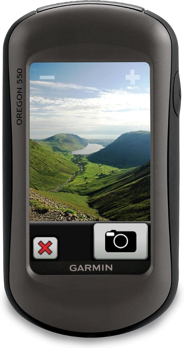
The Garmin Oregon 550 is a waterproof hiking GPS built around a three-inch sunlight-readable color touchscreen. It carries a 4.0 rating and brings together map browsing, photography, orientation, and elevation tracking in a durable package. Its interface offers more room for detailed route review than the smaller eTrex displays.
We may earn a commission when you buy through this link, at no additional cost to you.
A 3.2-megapixel autofocus camera with 4x digital zoom is integrated for documenting caches and surrounding locations. The three-axis tilt-compensated electronic compass displays heading while the user is standing still, and the barometric altimeter tracks pressure changes to help pinpoint altitude and keep an eye on changing weather conditions.
A worldwide built-in basemap with shaded relief provides a useful overview out of the box, and a MapSource microSD card can add more detailed maps. The limitation is that the base map may not be detailed enough for every expedition without regional map data. The camera specification also does not mention automatic coordinate geotagging, and no modern wireless cache-update function is listed.
The Oregon 550 is a solid recommendation for users who want a classic Garmin touchscreen handheld with a built-in camera. It suits general hiking, waypoint navigation, and casual geocaching, while users needing extensive preloaded caches, satellite imagery, or advanced wireless functions may prefer the Montana 680 or GPSMAP 66s.
The three-inch sunlight-readable color screen is comfortable for reviewing terrain and navigating through waypoint menus. A worldwide shaded-relief basemap offers context before additional detailed maps are added.
The tilt-compensated compass and barometric altimeter support field orientation and elevation tracking. The integrated autofocus camera removes the need for a separate trail camera when documenting a cache.
We may earn a commission when you buy through this link, at no additional cost to you.
The Garmin Oregon 200 is a compact portable GPS system designed around a rugged 2.6-inch color touchscreen. Its 3.2 rating is the lowest among the listed products, but the device still provides a high-sensitivity receiver, worldwide basemap, and dedicated geocache profile in a portable enclosure.
We may earn a commission when you buy through this link, at no additional cost to you.
The screen uses 240 by 400 pixels, offering a clear color interface that should appeal to users who want touch operation without carrying a larger handheld. Five selectable profiles cover automotive, marine, recreation, fitness, and geocache use, allowing the same unit to adapt to different activities. The built-in worldwide basemap also provides a useful baseline away from the United States.
Compared with the eTrex 22x, eTrex 32x, and Oregon 550T, the supplied data does not mention microSD expansion, a digital compass, a barometric altimeter, an integrated camera, GLONASS, or waterproofing. It also does not indicate Geocaching Live updates, extensive preloaded cache data, or wireless smartphone connectivity. Those omissions make it more appropriate for basic waypoint navigation than demanding geocaching workflows.
The Oregon 200 is best for casual geocachers who want a portable touchscreen, worldwide map, and straightforward profile selection. It can serve as a simple backup navigator or general hiking unit, but serious cache hunters should prioritize a newer model with more detailed mapping, expanded storage, and current connectivity.
The 2.6-inch color display provides a practical middle ground between a very small monochrome screen and a large mapping handheld. Rugged touch-screen construction supports use in ordinary outdoor conditions.
Five profiles support automotive, marine, recreation, fitness, and geocache use. This makes the Oregon 200 adaptable beyond caching, although its feature set remains intentionally basic.
We may earn a commission when you buy through this link, at no additional cost to you.
Choose a handheld by matching satellite positioning, mapping, navigation sensors, power, connectivity, and physical controls to the types of routes and cache logs you expect to handle. The best device is the one that remains readable and dependable where your trip leaves cellular coverage behind.
Multi-GNSS support can improve positioning when a handheld has access to more than one satellite system. The eTrex SE supports GPS, GLONASS, Galileo, BeiDou, and QZSS, while the Montana 680 adds GLONASS to GPS and the listed generic model supports GPS, Galileo, BeiDou, and QZSS. Additional systems may be useful beneath dense canopy, around steep canyon walls, or in other places where satellite visibility is inconsistent.
Multi-GNSS is useful, but it should not replace realistic expectations about accuracy. A model stating six-foot precision may provide a nominal target rather than a guaranteed result in every environment. Downloaded maps, clear sky visibility, stable positioning, and route planning remain important parts of accurate navigation.
Prioritize broad multi-GNSS support when your caching regions have challenging terrain or heavy cover. A standard GPS and GLONASS combination may be sufficient for open trails, and basic receivers can still serve travelers whose routes stay in straightforward areas.
Every reliable geocaching trip needs mapping that works without a cell signal. The eTrex 22x and eTrex 32x include preloaded Topo Active maps with routable roads and trails, the GPSMAP 66s includes TOPO maps for the United States and Canada, and the generic handheld includes USA topographic maps. The Oregon 200 and Oregon 550 provide worldwide basemaps, with the Oregon 550 also supporting more detailed maps through a MapSource microSD card.
Internal memory and card expansion determine how much additional data you can prepare. The eTrex 22x and 32x provide eight gigabytes plus a microSD slot, while the generic handheld lists 32 gigabytes of internal storage. Check regional coverage before purchasing because a worldwide basemap may not include the trail-level detail needed for a specific cache.
Choose a device with both usable preloaded maps and room for the regions you visit. Download maps before leaving reliable service, and keep a separate paper map or phone backup for critical routes.
Screen size affects how much terrain, route, and waypoint information can be reviewed at once. The 2.2-inch eTrex displays prioritize portability, while the 3-inch GPSMAP 66s and Oregon models offer more space for detailed map work. The Oregon 200 uses a compact 2.6-inch color screen, and the generic model uses a 3.2-inch sunlight-readable display.
Touchscreens make browsing maps and menus visually direct, but physical buttons can be more reliable with wet fingers, cold conditions, or gloves. The eTrex SE, eTrex 10, and eTrex 22x emphasize traditional physical operation. The generic handheld also combines a large display with physical buttons, offering an alternative to touch-only control.
Balance readability against pack weight. A larger screen helps during route review, but a smaller rugged unit may be easier to carry and operate one-handed. Confirm sunlight readability, color depth, and resolution before committing to a model.
A digital compass helps determine direction even when the handheld is stationary, and it can reduce dependence on the orientation of a map. The eTrex SE and eTrex 32x list a digital or three-axis compass. The GPSMAP 66s, generic rugged handheld, Oregon 550T, Oregon 550, and Montana 680 family also provide compass capabilities, although the supplied descriptions vary by model.
A barometric altimeter estimates altitude from pressure and can help identify elevation changes along a route. It is listed for the eTrex 32x, GPSMAP 66s, generic handheld, Oregon 550T, and Oregon 550. These tools are useful when a cache description refers to terrain, elevation, or a recognizable landform.
Choose a compass and altimeter when you navigate frequently on routes with elevation changes or need a fixed heading. For simple coordinate retrieval along a familiar path, these sensors are less critical than readable mapping and dependable positioning.
Battery endurance should be matched to the length and remoteness of a trip. The eTrex 22x and eTrex 32x list up to 25 hours in GPS mode, while the eTrex 10 offers up to 20 hours. The eTrex SE supports up to 168 hours in standard mode and up to 1,800 hours in expedition mode with two field-replaceable AA batteries, although those batteries are not included.
Rechargeable models simplify routine charging. The generic handheld provides up to 36 hours from a full charge and uses a standard USB-C cable. Before choosing, consider whether a model offers replaceable batteries for long expeditions or a sealed internal battery for convenience and water resistance.
Budgeting extra power is wise. Carry spare cells for an AA-powered unit, verify the battery type for the eTrex SE, and use a protective case or low-power screen settings on any rechargeable device. Actual run time varies with GNSS mode, display use, wireless features, temperature, and battery quality.
Wireless cache features can make a trip easier by placing descriptions, hints, and logs on the device before coverage disappears. The eTrex SE provides automatic Geocaching Live updates through the Garmin Explore app. The GPSMAP 66s supports Geocaching Live mobile syncing, and the Montana 680 includes 250,000 preloaded worldwide geocaches from Geocaching.com.
The eTrex SE also uses the Garmin Explore app for trip planning, software updates, active weather, and smart notifications. These functions require a compatible smartphone and preparation before the route. The eTrex 10 supports paperless geocaching, which is useful for manually loading cache information even without automatic syncing.
Choose live updates for frequent cache hunting and preloaded geocaches for travel-ready convenience. If your workflow depends on current hints, logs, or field notes, confirm app compatibility and make sure you can download the necessary information before leaving coverage.
An integrated camera removes the need to carry a separate trail camera and can provide useful visual documentation. The Oregon 550T includes a 3.2-megapixel autofocus camera with 4x zoom, the Oregon 550 uses the same stated camera configuration, and the Montana 680 offers an eight-megapixel camera capable of coordinate geotagging according to its description.
Weather information adds planning value before a hike. The eTrex SE and GPSMAP 66s support active weather functions when paired or connected. The Oregon 550's barometric altimeter can also help keep track of changing pressure, although that does not replace a forecast or local weather alert.
Camera-equipped models make sense for geocachers who routinely document finds or landscape evidence. Weather-capable devices are better for changing mountain conditions. Neither feature should substitute for route-specific preparation, backup navigation, and an awareness of local forecasts.
Outdoor electronics need protection from rain, splashes, dust, and impacts. The eTrex SE, eTrex 10, Oregon 550T, and Oregon 550 are described as water-resistant or waterproof to IPX7 standards. The generic rugged handheld has an IP66 rating, while the eTrex 22x and eTrex 32x are described as rugged handhelds without a specific water-resistance figure in the supplied data.
Water-resistance ratings are not the same as full submersion protection. Always follow the manufacturer's care guidance, close ports and covers correctly, and dry a device before charging it. A protective case can add impact protection, but it may make a compact handheld less pocketable.
Match durability to the environment. IPX7 protection is well suited to rain-soaked hikes, while an IP66-rated unit offers protection against dust and powerful water jets under its stated conditions. For demanding terrain, consider the overall enclosure, secure battery door, strap attachment, and available accessories.
Before leaving, charge the handheld or install fresh batteries, update its software, and confirm that the date, time, and position are correct. Download the required topographic regions, geocache details, routes, and any useful weather information while reliable cellular service is available. For a wireless model, complete pairing and synchronization through the compatible app before entering remote areas.
At the trailhead, confirm the displayed position, set the appropriate map layer, and check the route, waypoint list, compass heading, and altimeter reference when available. Save the starting point and critical turns, then retain a paper map and another navigation method as a backup. Follow the physical safety guidance for your route rather than relying solely on the screen, and remain alert to terrain, weather, and changing conditions.
After the trip, remove any batteries if the unit will be stored for a long period, clean dirt and moisture from the casing, and keep the contacts and ports dry. Store the device in a moderate, dry environment rather than in a hot vehicle. Check the listing for included mounting or power accessories, and use a screen protector or compatible case if it reduces glare, improves grip, or protects the display during transport.
A dedicated handheld is usually better when a route crosses areas with weak or absent cellular service because it can retain maps and cache data offline. Smartphones are often more convenient for browsing and updates when coverage is good, but a rugged handheld provides physical controls, replaceable batteries on some models, and reliable field navigation. Many geocachers use both, carrying the phone for searching and the handheld for the route.
Multi-GNSS can be helpful in heavily wooded areas, steep canyons, and other places where satellite reception is difficult. The eTrex SE supports GPS, GLONASS, Galileo, BeiDou, and QZSS, while several alternatives use GPS and GLONASS. It is not mandatory for every outing, but broader support offers useful flexibility in challenging terrain.
Reliable offline mapping and accurate positioning are the foundation. Display readability, storage, battery life, and cache updates should be considered next. A compass and altimeter can improve route awareness, while a camera is valuable for documentation. The best choice depends on whether your priority is simple hiking, live cache information, navigation sensors, or photo capture.
Many Garmin handhelds can store geocache information for offline use. The eTrex SE provides automatic Geocaching Live updates when paired with the Garmin Explore app, while the Montana 680 includes a large preloaded worldwide cache collection. The eTrex 10 supports paperless geocaching. Check app compatibility and synchronize all required cache details before losing cellular coverage.
AA batteries are convenient for long expeditions because users can carry spares, while a rechargeable battery is simpler for routine outings with reliable charging access. The eTrex SE provides especially long battery options in standard and expedition modes, though its batteries are not included. The generic handheld offers up to 36 hours and uses standard USB-C charging.
Touchscreens provide a large, visually intuitive map area and are useful for detailed route review. Physical buttons can be easier to operate with gloves, in rain, or while moving quickly. The eTrex models generally favor buttons, the Oregon and Montana models emphasize touchscreens, and the generic rugged handheld combines a large display with physical buttons.
A camera is helpful if you routinely photograph caches, document difficult finds, or want geotagged images linked to coordinates. The Oregon 550T, Oregon 550, and Montana 680 provide integrated cameras. If photography is occasional, a model without a camera may be lighter and simpler, and you can carry a separate phone or compact camera.
Storage needs depend on the regions you visit and the detail of the maps you download. The eTrex 22x and 32x include eight gigabytes of internal memory plus a microSD slot, while the generic handheld lists 32 gigabytes. Check coverage before loading maps and avoid relying solely on a broad worldwide basemap for detailed trail navigation.
The Garmin eTrex 22x is the most balanced overall recommendation because it combines a compact design, readable color display, preloaded Topo Active maps, GPS and GLONASS, expandable storage, and dependable battery life. The eTrex SE is the budget-conscious choice for geocachers who prioritize automatic cache updates, broad multi-GNSS support, and exceptional expedition endurance.
At the premium end, the Garmin Montana 680 offers the most explicitly geocaching-focused feature set, including 250,000 preloaded worldwide caches, route management, a large touchscreen, and a coordinate-aware camera. Prioritize offline mapping and positioning first, then add connectivity, sensors, weather tools, and a camera according to the way you actually cache. Keep a paper map and backup navigation method for every trip.
Current prices, availability, bundle contents, map coverage, and accessory options can change, so check the listing before buying. For renewed devices, inspect condition and confirm that the display, controls, sensors, ports, camera if present, and battery compartment operate correctly.


