
Garmin ECHOMAP Ultra 2 126sv
4.9Editor score
Twelve-inch chartplotter display
Garmin Navionics+ included
Wireless sonar sharing
Multi-band GPS positioning
Screen recording capability
A chartplotter for offshore fishing combines marine navigation, high-detail sonar, and vessel integration in a single helm display. The right unit helps anglers mark offshore structure, interpret currents and bottom changes, find productive fishing areas, and return to those locations safely. Display size, transducer support, mapping, control options, and network connectivity all influence performance.
This guide compares ten chartplotters based on their supplied specifications, customer ratings, display capabilities, sonar functions, navigation features, connectivity, and integration options. It covers premium all-in-one systems, more accessible packages, traditional control-head designs, and smaller displays, with special attention to the features that matter when fishing beyond sheltered waters.
Each review identifies the strongest benefits, practical limitations, and ideal boating setup for its featured chartplotter. The top selections show which models stand out for different priorities, from detailed imaging to broad networking. Product listings and pricing can change over time, so readers should confirm the current bundle, transducer inclusion, chart coverage, and compatibility before purchasing.
4.9Editor score

4.7Editor score

4.5Editor score
As an Amazon Associate we earn from qualifying purchases.
The comparison covers display size, sonar approach, included navigation content, connectivity, and practical limitations, helping offshore anglers identify the most suitable system for their boat and fishing style.




The Humminbird XPLORE Series earns a 4.7 customer rating and stands out as a capable offshore platform because it combines wide side-scan coverage, deep-sounding sonar, a large touchscreen, and serious networking options. Its MEGA Side Imaging+ reaches 200 feet on each side, while MEGA Down Imaging+ provides 200 feet of depth coverage. Together, those capabilities offer a detailed view of structure, drop-offs, and fish-holding areas.
We may earn a commission when you buy through this link, at no additional cost to you.
Navigation is another major strength. The built-in GPS works with an enhanced Humminbird Basemap covering more than 10,000 lakes and coastal waters, including terrain, markers, hazards, and marina locations. A LakeMaster and CoastMaster VX card for U.S. and Canadian regions is also included. AutoChart Live can build maps in real time, recording depth contours, bottom hardness, and vegetation with eight hours of built-in recording time.
The control scheme is well suited to an active helm. Users can operate the ten-inch interface by touchscreen or keypad, which can be valuable when spray, glare, or rough water makes precise touch input less convenient. Bluetooth supports wireless anchor control and smartphone notifications, while Ethernet, NMEA 2000, and compatibility with Minn Kota trolling motors and Cannon products make the unit adaptable to a developed offshore electronics system.
The important trade-off is that this listing is a control-head-only model without a transducer. That means an angler must verify transducer compatibility and add the appropriate sensor rather than assuming the package is ready to scan immediately. The feature set is extensive, but full installation may also require careful network planning. Buyers seeking the broadest built-in offshore imaging and mapping combination should examine this model first.
This is the strongest all-around recommendation in the guide for anglers who value a large display, broad side-scan views, automatic mapping, and vessel-wide expansion. It is particularly suitable for a console or upper helm where visibility, detailed structure interpretation, and integration with a trolling motor or other marine electronics matter more than minimum component count.
MEGA Side Imaging+ provides 200-foot coverage on each side, helping offshore anglers inspect formations beyond the immediate path of the boat. Combined with 200-foot Down Imaging+ depth coverage and Dual Spectrum CHIRP, it provides complementary views of bottom composition, cover, and suspended targets.
AutoChart Live records depth contours, bottom hardness, and vegetation while the boat is underway. That makes the unit useful both as a live navigation aid and as a platform for developing a more personal record of offshore habitat.
We may earn a commission when you buy through this link, at no additional cost to you.
The Garmin ECHOMAP UHD2 94sv carries a 4.7 rating and offers one of the most coherent packages in the guide. It combines a nine-inch sunlight-readable touchscreen, an included GT56-TM transducer, Garmin traditional, ClearVü, and SideVü sonar, plus built-in Garmin Navionics+ U.S. coastal charts. For a new offshore electronics setup, that combination reduces uncertainty about major included components.
We may earn a commission when you buy through this link, at no additional cost to you.
The display is designed for challenging light conditions, with improved detail, clarity, and viewing angle. Traditional sonar helps interpret individual targets, ClearVü provides a clearer traditional-style image, and SideVü helps reveal structure beside the boat. Since the GT56-TM transducer is included, the system arrives with the essential scanning hardware rather than requiring a separate transducer purchase.
Connectivity broadens the package further. Built-in Wi-Fi lets one compatible ECHOMAP UHD2 chartplotter share sonar, waypoints, and routes with another. It also wirelessly connects to a Garmin Force trolling motor for route following, waypoint navigation, speed control, and battery monitoring. Those features can make the display more central to the helm without adding every peripheral to a physical connection.
The main limitation is that no radar is included in the stated package. Offshore anglers who need radar for weather, traffic, or long-range target detection must add compatible equipment. The nine-inch display may also feel modest in a very large console, particularly when split views include mapping, sonar, and engine information. Even so, the bundled transducer and coastal chart coverage make this a practical, well-rounded choice.
This model is ideal for owners of a center-console, sportboat, or coastal cruiser who want a readable display, modern scanning sonar, and wireless trolling motor control without assembling every core component separately. It is especially attractive to offshore anglers who want coastal charts and SideVü detail but do not need the largest possible screen.
The included GT56-TM supports Garmin traditional, ClearVü, and SideVü scanning sonar, giving buyers immediate access to several imaging styles. This makes the 94sv an appealing option for a first serious offshore electronics installation.
Wi-Fi sharing allows compatible displays to exchange sonar, waypoints, and routes. Connection to a Force trolling motor adds route following, waypoint navigation, speed control, and battery-status information directly through the chartplotter.
We may earn a commission when you buy through this link, at no additional cost to you.
The Simrad NSS 4 receives a 4.6 rating and is designed as a premium all-in-one chartplotter and fishfinder for sportfishing vessels and cruisers. Its combination of a SolarMAX HD display, an eight-core Qualcomm processor, dual-channel CHIRP, Active Imaging HD support, and current C-MAP chart options gives it a strong foundation for a sophisticated offshore electronics system.
We may earn a commission when you buy through this link, at no additional cost to you.
Performance is central to the design. The processor supports smoother transitions and faster updates, which can help when moving among charts, sonar, routes, and vessel information. The interface combines touchscreen operation, a rotary dial, and a keypad, giving users several ways to navigate menus and adjust settings. Users can also pin applications and customize screens to reduce the number of steps needed while fishing or underway.
Fishfinding tools are particularly relevant offshore. Built-in dual-channel CHIRP provides flexible target information, while Active Imaging HD support adds a high-definition imaging option. The navigation side supports C-MAP DISCOVER X or REVEAL X, along with CMOR Mapping, Standard Mapping, and additional options. FISHCast, powered by ROFFS, can deliver offshore fishing hotspots, although a subscription is required.
Integration is another major attraction. The NSS 4 supports the Simrad ecosystem and third-party technologies including Mercury SmartCraft Connect and SiriusXM WM-4. That makes it relevant to boats with multiple displays, engine instruments, audio equipment, and other networked devices. The trade-off is complexity: a buyer comfortable with advanced helm systems may extract more value than someone seeking a simple standalone display.
The NSS 4 is a compelling choice for offshore anglers who want fast response, flexible controls, advanced sonar, and a broad integration roadmap. It is particularly appropriate for larger sportfishing boats and cruisers where a single high-performance display can serve as the center of a connected helm.
The eight-core Qualcomm processor is intended to keep navigation, sonar, and network functions responsive. On a vessel with several connected devices, the emphasis on quick transitions and updates can make day-to-day helm operation feel more cohesive.
FISHCast provides access to ROFFS-ranked fishing hotspots through a C-MAP subscription. It can complement direct sonar interpretation by helping anglers decide where to investigate, although the ongoing subscription should be considered separately.
We may earn a commission when you buy through this link, at no additional cost to you.
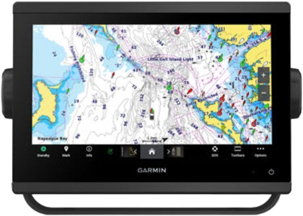
The Garmin ECHOMAP Ultra 2 126sv has a 4.9 customer rating, the highest in this guide, and brings a 12-inch display to the helm. It is particularly compelling for offshore anglers who need enough screen area to compare mapping, sonar, route, and recording information without constantly switching between compact views.
We may earn a commission when you buy through this link, at no additional cost to you.
Garmin Navionics+ is included, providing a strong navigation foundation without requiring a separate chart purchase for the basic mapping function. Multi-band GPS improves position accuracy, which can be particularly helpful offshore where charted hazards, narrow channels, and isolated structure make precise location data important. The unit can also wirelessly network with compatible systems to share sonar, waypoints, and routes.
Screen recordings are another useful feature for anglers who want to preserve a catch or an interesting sonar sequence. Recording can help document offshore structure, compare different fishing spots, and share memorable moments without relying on a separate camera to capture the chartplotter itself. The wide screen gives recorded information a more natural presentation than a very compact display could provide.
A significant limitation is explicit in the product information: the GT56UHD-TM transducer is not included and must be purchased separately. The 12-inch housing also requires adequate console space, and a larger display can be more exposed in harsh conditions if it is mounted poorly. Buyers should plan the installation carefully and budget for the appropriate sonar hardware.
Despite those considerations, the 126sv is the most refined choice for a large modern helm, particularly when visual clarity, position accuracy, wireless sharing, and screen space are priorities. It is well suited to offshore anglers willing to build the complete system around the chartplotter rather than purchase a preassembled sonar package.
The 12-inch panel gives charts, sonar returns, routes, and recording tools room to remain visible together. This is useful on offshore trips where finding structure, interpreting a graph, and checking a heading are all part of making the next move.
Multi-band GPS supports improved position accuracy, while wireless networking shares sonar, waypoints, and routes with compatible displays. Together, these functions can make a multi-screen helm feel like a connected system rather than a collection of independent tools.
We may earn a commission when you buy through this link, at no additional cost to you.
The Simrad GO Series earns a 4.4 rating and offers a practical way to add modern navigation and fishfinding to a sportboat, center-console, or smaller cruiser. Based on the supplied information, the GO9 configuration combines GPS navigation, sonar support, radar capability, C-MAP Discover mapping, an HDI transducer, Wi-Fi, and NMEA 2000 integration.
We may earn a commission when you buy through this link, at no additional cost to you.
Its mapping package is unusually useful for coastal and inland waters. C-MAP Discover includes Vector Charts, Custom Depth Shading, Tides and Currents, high-resolution bathymetric contours, and broad coverage in the United States and Canada. Those features can help an angler interpret drops, channels, and current patterns rather than relying only on a basic background chart.
The included 83/200 kHz HDI transducer supports clear CHIRP sonar and DownScan Imaging. CHIRP helps identify fish targets and bottom features, while DownScan Imaging gives a clearer view of the structure immediately below the boat. The ability to add radar further extends the unit's usefulness for offshore navigation and weather awareness, depending on the exact configuration purchased.
Connectivity options are broad for a GO-series system. Built-in Wi-Fi allows a phone or tablet to mirror the display and access charts, radar, and other onboard functions. NMEA 2000 also creates a path to integration with additional marine equipment. The main limitation is that this general-purpose platform does not offer the same high-resolution side-imaging emphasis as the dedicated imaging systems higher in the ranking.
The GO Series is a good fit for an angler who values charts, tides, currents, radar expansion, and system connectivity more than maximum sonar detail. It is a sensible choice for a smaller offshore boat that needs a capable central display without a highly specialized imaging architecture.
Custom Depth Shading, Tides and Currents, and high-resolution bathymetric contours help turn the chart into an active fishing tool. These features are especially relevant when structure, channels, and current boundaries influence where fish hold.
Radar options, smartphone mirroring, and NMEA 2000 support make the GO9 adaptable as a boat's electronics foundation. It can serve as the central display while additional sensors and displays are added over time.
We may earn a commission when you buy through this link, at no additional cost to you.
The ECHOMAP Ultra 2 LiveScope Plus Bundle has a 4.4 rating and targets anglers who want a large, bright chartplotter paired with specialized live-sonar capability. The supplied details emphasize a crisp touchscreen, vivid high-contrast colors, Garmin Navionics+ mapping, and wireless sharing, making the bundle especially relevant to fishermen focused on seeing moving targets around structure.
We may earn a commission when you buy through this link, at no additional cost to you.
Display quality is a major strength in bright offshore conditions. A sunlight-readable ten-inch screen and high-contrast color palettes can make weak returns and subtle bottom transitions easier to interpret. Garmin Navionics+ supplies the navigational foundation, and a one-year subscription provides daily updates so chart content can remain current as the angler continues to use the system.
Wireless information sharing is another meaningful advantage. Compatible Ultra 2 and UHD2 chartplotter and fishfinder systems can exchange data, which is helpful on a boat with more than one display or in a network that includes other Garmin equipment. The result is a more collaborative helm in which information is not confined to a single screen.
The most important buying consideration is exact bundle verification. The supplied product information highlights the LiveScope Plus bundle but does not enumerate every included component in the same detail as the other listings. Buyers should confirm the chartplotter size, transducer, LiveScope hardware, mounting pieces, cables, and map coverage before ordering. They should also ensure the LiveScope installation will suit their hull, transducer location, and fishing style.
This package is a strong option for an offshore angler whose priority is live target visibility and a high-contrast ten-inch interface. It may be especially attractive for anglers already invested in Garmin equipment or planning to build a multi-display system using compatible Ultra 2 and UHD2 units.
Sunlight readability and high-contrast color palettes help important sonar details remain visible in exposed conditions. That clarity is especially useful when comparing live target movement against a textured background of reef, rock, or steep bottom.
The included one-year daily update access keeps Navionics+ content current during the subscription period. Wireless sharing allows compatible Garmin displays to pass information across the helm, reducing the need to move between isolated screens.
We may earn a commission when you buy through this link, at no additional cost to you.
The Garmin GPSMAP 943xsv SideVü has a 4.7 rating and is built around ultra high-definition scanning sonar, Panoptix support, preloaded mapping, and improved display optics. It is a recognizable Garmin platform for anglers who want detailed side-scan information and a capable multifunction display at the helm.
We may earn a commission when you buy through this link, at no additional cost to you.
The defining feature is ultra high-definition scanning sonar. In practical terms, this category is intended to provide clearer structure and target definition than basic fishfinder graphics, helping offshore anglers recognize drop-offs, weed edges, rock formations, and bait concentrations. Panoptix sonar support extends the system's potential for a more dimensional view when the appropriate compatible equipment is used.
Preloaded mapping gives the unit immediate navigational utility, and the improved display optics support clear interpretation of sonar and chart detail. That combination matters offshore because a display must communicate both where the boat is and what lies beside or beneath it. The 943xsv is therefore more than a traditional chartplotter; it is designed to operate as a central fishfinding and navigation interface.
Buyers should still examine the exact package contents and transducer situation. The product title identifies the SideVü model, but the supplied data does not explicitly itemize every accessory. Compatibility with optional sonar, radar, and network equipment also requires planning so that cables, mounts, and network topology fit the vessel. More advanced imaging setups can introduce a steeper learning curve than a basic CHIRP unit.
The GPSMAP 943xsv is a compelling pick for offshore anglers who specifically value Garmin's scanning-sonar ecosystem, preloaded charts, and potential for Panoptix expansion. It is well suited to owners who want a proven multifunction platform and may later build a connected helm around additional Garmin displays and sensors.
Ultra high-definition scanning sonar is the main attraction. It gives an angler a more detailed way to inspect the water beside the boat, which can be essential when searching productive drop-offs and offshore structure.
Panoptix support provides an upgrade path for compatible installations. Buyers planning a larger electronics system should identify the intended transducer and network architecture early so the chartplotter fits the complete helm.
We may earn a commission when you buy through this link, at no additional cost to you.
The Humminbird Helix 5 Chirp GPS G3 receives a 4.5 rating and is the most approachable chartplotter in this guide. It combines a five-inch color display, Dual Spectrum CHIRP sonar, a broad built-in basemap, and AutoChart Live in a traditional softkey-controlled layout. It is a logical starting point for an angler who wants modern fishfinding and navigation without moving directly to a large premium helm.
We may earn a commission when you buy through this link, at no additional cost to you.
Dual Spectrum CHIRP offers two search methods. Wide Mode provides maximum coverage for locating fish-holding structure, while Narrow Mode offers more detailed scanning and precise two-dimensional target separation. The Low-Q transducer supports that separation, helping an angler distinguish targets and examine the shape of bottom features with more confidence than a basic frequency-based fishfinder.
Navigation coverage is more impressive than the small display might initially suggest. Humminbird Basemap includes more than 10,000 lakes and continental U.S. coastlines. Premium LakeMaster, CoastMaster, and Navionics charts are compatible for anglers who need more detail. AutoChart Live records depth contours, bottom hardness, and vegetation with eight hours of built-in recording time, and it can use AutoChart Zero Line SD cards for expanded capacity.
The principal compromise is size. A five-inch screen is easy to install and straightforward to use, but it limits how much chart, sonar, and engine information can be viewed at once. It is also less integrated than the premium systems, which provide more extensive networking and specialized imaging. That makes it better suited to a single-display boat or anglers who value simplicity over multi-panel sophistication.
The Helix 5 Chirp GPS G3 is recommended for budget-conscious offshore beginners, smaller boats, and anglers who prefer dependable keypad operation in rough weather. It offers the most important elements of a modern chartplotter at a manageable scale, including CHIRP, coastal mapping, and automatic chart creation.
Wide Mode is useful for quickly scanning a large area, while Narrow Mode provides the detail needed to examine structure and separate targets. Having both options makes the unit adaptable to different stages of an offshore search.
AutoChart Live records contours, bottom hardness, and vegetation while the boat moves. Eight built-in hours offer a starting point for charting, while compatible SD cards allow anglers to expand storage.
We may earn a commission when you buy through this link, at no additional cost to you.
The Simrad NSS Evo3S lineup has a 4.4 rating and centers on a high-definition 12-inch SolarMax IPS display with an iMX 8 processor. The supplied product data describes the NSS12 evo3S configuration, which combines preloaded C-MAP US Enhanced charts, powerful fishfinding processing, broad vessel integration, and both touchscreen and physical controls.
We may earn a commission when you buy through this link, at no additional cost to you.
The display uses SolarMax IPS technology, and its high-definition 12-inch format provides ample room for navigation and sonar. The iMX 8 processor is designed to deliver faster response and seamless screen transitions, useful when an angler moves between mapping, fishfinding, and onboard systems. Built-in GPS makes the unit a complete chartplotter rather than only a sonar display.
C-MAP US Enhanced inland and coastal charts provide a strong navigational base. Fishfinding performance can be expanded with Active Imaging sonar, StructureScan 3D, and HALO radar. This compatibility gives the NSS12 evo3S potential for a sophisticated offshore system, especially on a boat that already uses compatible Simrad equipment.
Vessel-wide integration is one of the strongest aspects. Beyond sonar and radar, the platform can support real-time engine and fuel-efficiency monitoring, onboard audio control, and other connected functions. The control options are also well considered: users can switch between an all-weather multi-touch interface and a keypad with a rotary dial, which is helpful when the helm gets wet or movement makes touch control imprecise.
The main issue is configuration complexity. The listing covers 9-inch, 12-inch, and 16-inch variants, while the supplied specifications focus on the NSS12 evo3S. Buyers need to verify the exact display size, transducer, radar, and included accessories. Those checks are essential, but for an angler seeking a large, flexible, highly connected helm, the Evo3S remains a strong option.
The 12-inch SolarMax IPS display gives charts and sonar more visual space than compact units. Multi-touch gestures support fast navigation, while the physical keypad and rotary dial remain available for less precise conditions.
The iMX 8 processor supports real-time monitoring and extensive system expansion. Compatibility with Active Imaging, StructureScan 3D, HALO radar, engine data, and onboard sound makes the display useful across more than fishing tasks.
We may earn a commission when you buy through this link, at no additional cost to you.
The Garmin ECHOMAP UHD2 53cv carries a 4.5 rating and provides a compact way to add Garmin chartplotter and fishfinding functions to a smaller boat. Its five-inch color display, CHIRP traditional sonar, ClearVü scanning sonar, Wi-Fi connectivity, and preloaded Garmin Navionics+ U.S. inland mapping cover the core functions many anglers need on an entry-level helm.
We may earn a commission when you buy through this link, at no additional cost to you.
The two principal sonar views serve different purposes. CHIRP traditional provides familiar fish arches and fish-holding structure, while ClearVü offers a clearer view of the bottom and nearby objects. Seeing both from one display helps anglers combine target identification with a more detailed understanding of the seabed, which is valuable even when searching relatively shallow coastal water.
Wi-Fi allows compatible chartplotters to share information, making the unit more flexible within a multi-display setup. Preloaded Navionics+ U.S. inland mapping provides detailed lake navigation, while the chartplotter's navigation functions create a useful foundation for a small center-console, pontoon, or fishing boat.
The compact five-inch screen is the central limitation. It is convenient to install and read at close range, but it cannot present as much chart and sonar information as a 9-inch, 10-inch, or 12-inch model. The included mapping emphasis is also on U.S. inland waters, so offshore buyers outside that coverage may need additional charts. There is no mention of radar in the supplied specifications.
Despite those constraints, the 53cv is a useful first chartplotter for an angler who wants Garmin navigation, CHIRP, ClearVü, and wireless sharing in a smaller package. It is best suited to boaters who prioritize a straightforward, compact unit over large-screen visualization or heavily integrated offshore systems.
CHIRP traditional helps anglers identify fish targets and structure, while ClearVü sharpens the view of bottom shape and submerged features. Both add useful context when choosing a location to fish.
Wi-Fi sharing allows compatible ECHOMAP units to exchange information. The relatively small housing is also practical for consoles with limited space, although buyers should consider larger charts for more demanding offshore use.
We may earn a commission when you buy through this link, at no additional cost to you.
The best offshore chartplotter is the one that combines usable sonar, appropriate navigation detail, a readable helm display, and reliable integration with the equipment already on the boat. These factors deserve careful attention before purchase.
Sonar is the primary tool for finding offshore structure and interpreting what lies below the surface. Traditional CHIRP is versatile and easy to read, ClearVü and SideVü provide clearer structural images, and MEGA Side Imaging+ offers broad side coverage. Down Imaging adds a downward perspective, while Active Imaging HD and live-sonar functions can help identify moving targets. The best choice depends on whether the priority is wide searching, precise target separation, dramatic live views, or a combination of these tasks.
A chartplotter cannot provide the sonar experience promised by its display without a suitable transducer. Some packages include one, while the Humminbird XPLORE control-head-only listing and Garmin ECHOMAP Ultra 2 126sv specifically require separate hardware. Check whether the supplied unit supports the exact frequency, mounting method, and sonar channels you need. Also consider the hull shape and intended transducer position because improper installation can reduce performance or create installation problems.
Display size affects how much an angler can interpret at once. Five-inch models are compact and easy to mount, while 9-inch, 10-inch, and 12-inch screens make split views more practical. Bright sunlight readability, viewing angle, contrast, and color palette are equally important on an exposed offshore helm. A larger display is useful on large consoles, but it should be mounted securely and positioned to minimize glare and physical damage.
Useful offshore navigation requires more than a basic coastline. Look for high-resolution bathymetric contours, depth shading, tides and currents, hazards, marinas, and dependable position tracking. Garmin Navionics+, C-MAP Discover, and C-MAP US Enhanced appear across this guide, but regional coverage and included updates vary. Confirm that the chart data covers your fishing region, and consider whether a subscription is required for regular updates.
Touchscreens are convenient, but an offshore helm can involve spray, glare, cold hands, and movement. Keypads, softkeys, and rotary dials provide dependable alternatives and can be faster when adjusting sonar or navigation settings. The Simrad NSS 4 and NSS Evo3S combine physical controls with touch operation, while the Humminbird Helix 5 and XPLORE Series also support keypad operation. Choose a control scheme that remains comfortable in the conditions you actually encounter.
NMEA 2000, Ethernet, Wi-Fi, and Bluetooth determine how easily a chartplotter can share data with engines, trolling motors, radar, autopilot systems, and other displays. Wireless sharing is convenient but should not be treated as a replacement for every hardwired connection. A large offshore boat often benefits more from a planned network than from a display with many theoretical options. Check compatibility, cable requirements, port availability, and power requirements before choosing a model.
AutoChart Live can record depth contours, bottom hardness, and vegetation while the boat moves, allowing anglers to build custom charts of productive water. This is valuable offshore because informal knowledge of a wreck, reef, or productive drop-off can become a reusable map. Check included recording time, storage expansion, and export options. Custom mapping complements official charts rather than replacing them, so buyers still need dependable cartography and navigation data.
Some advanced features depend on ongoing services rather than being fully included. Simrad FISHCast, for example, requires a C-MAP subscription. The ECHOMAP Ultra 2 LiveScope bundle includes a one-year period for daily updates, while other chart data may be preloaded without a stated update period. Beyond subscriptions, buyers may need a transducer, mount, power connection, network cable, additional chart card, radar, or a compatible trolling motor. Considering the full system avoids surprises after installation.
Begin by installing the transducer where it can produce a clear and stable sonar picture, then connect the display using the appropriate power and network cables. Secure the mount so the screen is readable but protected from excessive glare and direct impact. Confirm that the GPS obtains a position, verify chart coverage for the intended area, and set the correct date, time, and units before leaving the dock.
On the water, use a split-screen layout to compare navigation with sonar. Begin with a conventional CHIRP or traditional view to understand the general bottom, then select ClearVü, SideVü, Down Imaging, Active Imaging, or live sonar when searching for particular structure. Mark productive areas, record noteworthy catches, and use AutoChart Live to save depth contours, bottom hardness, and vegetation. Avoid changing too many settings while actively fishing unless the new view has a clear purpose.
After each trip, rinse the display and transducer with fresh water, remove salt from connectors, and check that the mount remains tight. Protect the unit from prolonged direct sun when not in use, avoid allowing moisture to enter ports, and inspect cables for abrasion. Save routes and recordings, update charts or firmware when appropriate, and verify that the display, transducer, and network components still work together before the next offshore trip.
A larger display is useful when an angler wants to view mapping, sonar, engine data, and routes together. It also makes detailed structure easier to interpret. However, screen size alone does not determine performance, so transducer quality, sonar functions, GPS accuracy, mapping, and system integration remain equally important. A compact five-inch model can be sufficient on a smaller boat, while a large console often benefits from a 9-inch to 12-inch screen.
Side imaging is highly useful because it shows a broad area beside the boat rather than only what is directly below the transom. It helps anglers locate drop-offs, reefs, weed edges, and structure beyond the immediate path of the vessel. Traditional CHIRP and Down Imaging remain valuable complementary tools, and some anglers combine them with side imaging to search widely and then inspect targets more closely.
A package with an included transducer is generally simpler for a new installation because the core scanning hardware is already selected. A control-head-only model can be preferable for an existing boat with compatible equipment. In either case, confirm the transducer type, frequency, mounting style, cable length, and support for the display before ordering. A chartplotter without suitable sonar hardware cannot provide the intended fishfinding experience.
NMEA 2000 is important for sharing engine, fuel, temperature, and other vessel data, while Ethernet or similar hardwired networking can support high-bandwidth sonar and radar sharing. Wi-Fi is convenient for compatible displays and mobile-device integration, while Bluetooth may cover anchor control or notifications. The right combination depends on the electronics already aboard and how the boat is expected to expand.
Models with AutoChart Live can record information such as depth contours, bottom hardness, and vegetation while the boat travels. This creates custom charts of surveyed water, which can help an angler revisit productive offshore habitat. The process is best treated as a complement to official charts because chart updates, hazards, and regulatory information should still come from reliable marine cartography.
They can be, particularly when spray, glare, or movement makes icons harder to target. Many premium models solve this by adding keypads, softkeys, or rotary controls. An angler should test the interface while wearing wet hands, standing in a moving boat, and using sunglasses. A physical backup control can make speed and depth adjustments much easier when conditions deteriorate.
Radar is not required for every boat, but it can be valuable in poor visibility, developing weather, heavy traffic, or when detecting objects beyond normal visual range. Models such as the Simrad GO Series and NSS Evo3S support radar options, while other bundles may not include radar. Consider it as part of a broader safety and navigation plan rather than simply another fishing graphic.
Start with your existing electronics, transducer, trolling motor, radar, and preferred map ecosystem, because compatibility can determine which brand is most practical. Then compare display readability, side-imaging capability, control style, networking, and automatic charting. Garmin offerings in this guide range from compact to expansive systems, Humminbird emphasizes imaging and AutoChart Live, and Simrad provides strong processor power and broad integration options.
The Humminbird XPLORE Series is the top all-around recommendation because it combines broad MEGA Side Imaging+, deep Down Imaging+, a large touchscreen, AutoChart Live, and extensive networking, though it requires a separate transducer. The Garmin ECHOMAP Ultra 2 126sv is the premium choice for a large, highly connected helm, while the Humminbird Helix 5 Chirp GPS G3 offers the most approachable route into modern offshore chartplotter features.
For a complete mid-sized package, the Garmin ECHOMAP UHD2 94sv stands out with an included GT56-TM transducer, coastal charts, SideVü, and wireless Force trolling motor control. Large-boat owners who prioritize processing, customization, and integration should examine the Simrad NSS 4 or NSS Evo3S, while the Simrad GO Series offers a flexible approach for smaller offshore boats.
Before purchasing, confirm the display size, transducer, sonar functions, chart coverage, update terms, mounting requirements, and network compatibility. Product configurations and prices can change, and some of the featured models are sold in variants or bundles. Checking the current listing ensures that the chosen chartplotter includes the right offshore tools for the vessel and fishing style.