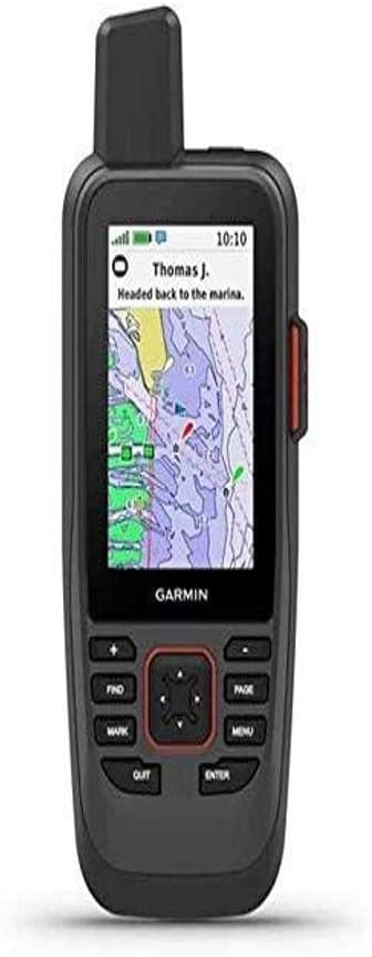
Garmin GPSMAP 86Sci
4.2Editor score
InReach satellite communications
Compatible chartplotter data streaming
Floating button-operated construction
Integrated remote control functions
A handheld GPS for boating must deliver dependable positioning, readable charts, intuitive controls, and enough endurance for a day on the water. The best units also tolerate spray, accidental drops, and changing weather while providing sailing, route, compass, and waypoint tools that remain useful away from the helm.
We compared ten Garmin handhelds using the specifications supplied for each model, with particular attention to marine charts, floating or water-resistant construction, display visibility, navigation functions, storage, satellite support, battery life, and practical extras such as wireless connectivity. The list includes dedicated marine units, rugged multisport navigators, and lower-cost traditional GPS devices.
Each review identifies the features most relevant to boaters and explains which sailors, anglers, and general navigators are most likely to benefit from that model. The top picks cover premium, overall, and budget options, while the complete rankings show how each device differs. Product availability, features, ratings, and prices can change, so confirm current listings before purchasing.
4.2Editor score

4.0Editor score
4.3Editor score
As an Amazon Associate we earn from qualifying purchases.
This side-by-side comparison highlights chart coverage, marine durability, navigation versatility, connectivity, and battery endurance so boaters can quickly identify the handheld that matches their sailing style and safety requirements.


The Garmin GPSMAP 79sc combines a high-resolution color display with preloaded BlueChart g3 coastal charts, making it a strong general-purpose choice for boaters who want a dedicated marine navigator rather than a hiking unit adapted for the water. Its 4.0 rating reflects a capable package, and the supplied specifications emphasize durability, floating construction, multi-constellation positioning, and substantial onboard storage.
We may earn a commission when you buy through this link, at no additional cost to you.
The most immediately useful boating feature is the combination of coastal charting and a rugged body designed to float. The unit has an IPX6 water-resistance rating at the unit level, while its scratch-resistant, fogproof glass is suited to exposed deck use. Support for GPS, GLONASS, Beidou, Galileo, QZSS, and SBAS broadens the available positioning signals, which can improve reliability in challenging surroundings.
Its internal capacity is another strength. The GPSMAP 79sc can store 10,000 waypoints, 250 routes, and 300 fitness activities, allowing a skipper to keep favorite channels, anchorages, hazards, and planned passages without constantly entering them. A three-axis tilt-compensated compass displays heading while stationary, and the barometric altimeter tracks pressure-related altitude changes. These tools make it useful for both navigation and general outdoor activities.
The trade-off is that the preloaded charts focus on coastal areas rather than providing a worldwide basemap. The specifications also do not list phone pairing or wireless management, so owners who depend heavily on Garmin Explore or other connected features may prefer a different model. Nevertheless, for boaters seeking a rugged, floating handheld with coastal charts, strong memory, and dependable battery life, the GPSMAP 79sc is the most balanced recommendation in this guide.
Floating construction reduces the consequences of a dropped handheld, while IPX6 water resistance provides confidence during spray, rain, and routine exposure near an open cockpit. The fogproof glass is also appropriate for changing conditions, although sensible storage remains important when the unit is not in use.
The tilt-compensated compass can show heading while the boat is stationary, which is useful when judging orientation in currents, around a marina, or while preparing a route. BlueChart coverage provides the marine mapping foundation without making the device dependent on a phone for basic passage planning.
We may earn a commission when you buy through this link, at no additional cost to you.
The Garmin GPSMAP 79s is built for boaters who need more geographic flexibility than a coastal-chart model can offer. Its worldwide basemap, floating body, color screen, and 4.2 rating make it a practical choice for international voyages, inland cruising, and mixed use on the water and ashore. It shares much of the durable design language of the 79sc while serving a different mapping need.
We may earn a commission when you buy through this link, at no additional cost to you.
The included worldwide basemap gives users a broader geographic foundation for travel beyond familiar coastal waters. Storage remains generous, with room for 10,000 waypoints, 250 routes, and 300 fit activities. That makes the device useful for maintaining detailed personal records, multiple boating destinations, and routes that may include land travel before or after a trip.
Positioning is supported across GPS, GLONASS, Beidou, Galileo, QZSS, and SBAS. The built-in three-axis tilt-compensated compass provides a heading indication even when motion is minimal, while the barometric altimeter assists with altitude-related tracking. The stated battery life reaches 20 hours in GPS mode, a useful figure for extended outings where charging opportunities may be limited.
Its central limitation is chart type: the supplied information identifies a worldwide basemap rather than preloaded BlueChart coastal charts. That may be perfectly adequate for general positioning and overseas travel, but a skipper focused on detailed coastal navigation should verify the available map content for the intended region. Despite that distinction, the GPSMAP 79s is an attractive rugged all-rounder with generous storage and true floating construction.
A worldwide basemap is particularly valuable for sailors crossing national borders or cruisers whose itinerary includes unfamiliar inland waters, harbors, and coastal regions. It broadens the device's role without changing its core floating, button-and-screen marine design.
The ability to retain 10,000 waypoints and 250 routes supports long-term organization of anchorages, boatyards, fueling points, and favorite destinations. It also makes the unit more useful to people who divide their time between boating, hiking, and other outdoor pursuits.
We may earn a commission when you buy through this link, at no additional cost to you.
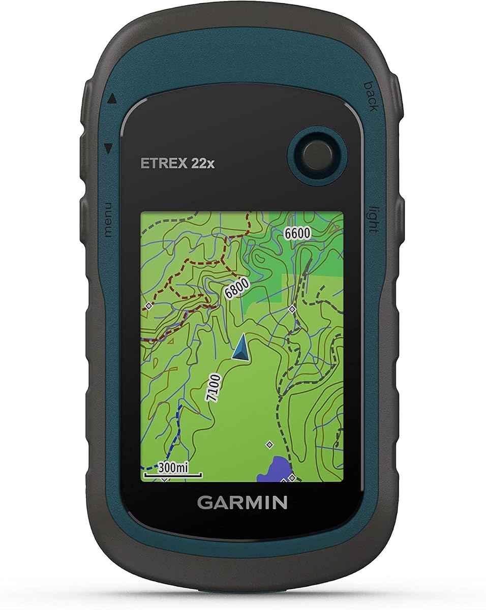
The Garmin eTrex 22x is the most straightforward budget choice in this roundup. It pairs a 4.3 rating with a sunlight-readable 2.2-inch color screen, preloaded TopoActive maps, and support for both GPS and GLONASS. Although it is a general handheld navigator rather than a floating marine model, its compact construction and long battery life make it useful for smaller boats and basic route-following.
We may earn a commission when you buy through this link, at no additional cost to you.
Its 240-by-320-pixel display is designed for readability in bright outdoor conditions, while the preloaded TopoActive maps include routable roads and trails. Although not a dedicated coastal-chart package, the device offers eight gigabytes of internal storage for map downloads and a microSD card slot for further expansion. That flexibility can help owners add relevant mapping for their normal cruising area.
Battery life is a major advantage. The eTrex 22x can run for up to 25 hours in GPS mode on two AA batteries, making it convenient for long days away from shore power. Support for GPS and GLONASS can improve tracking in locations where a basic single-constellation receiver may have fewer usable signals. Its rugged design also suits use in an open cockpit or as a shore-navigation companion.
The main drawback is the absence of listed marine-specific features such as preloaded BlueChart coastal charts, floating construction, sailing assistance, or integrated compass and altimeter. It also has a smaller screen than several higher-ranked options. For a boater who primarily needs an affordable, dependable route display, the eTrex 22x is a sensible value choice, especially when added marine mapping and protective carrying arrangements are acceptable.
The combination of eight gigabytes of internal memory and a microSD slot gives the eTrex 22x room to grow beyond its TopoActive base map. Boaters should check map availability and compatibility before an outing, since a general hiking navigator does not arrive with a dedicated coastal chart set.
A stated runtime of up to 25 hours in GPS mode reduces battery anxiety on fishing trips, coastal paddles, and day cruises. Using fresh AA batteries and keeping a spare set available remains a simple way to protect navigation during an extended outing.
We may earn a commission when you buy through this link, at no additional cost to you.
The Garmin GPSMAP 86Sci is the most feature-rich marine handheld in this guide. It combines a floating, water-resistant design with a sunlight-visible 3-inch display, button operation, BlueChart G3 coastal charts, and InReach satellite communications. Its 4.2 rating reflects a specialized device aimed at serious cruisers who value connectivity beyond cellular coverage.
We may earn a commission when you buy through this link, at no additional cost to you.
The major differentiator is InReach communication through the Iridium satellite network. Depending on a subscription, users can send and receive two-way text messages, share location, trigger an interactive SOS response, and obtain optional weather forecasts. This extends the handheld's role beyond route display and may be especially compelling for offshore, remote-coast, or extended voyages where ordinary mobile service is unreliable.
The GPSMAP 86Sci also integrates with a broader Garmin marine setup. It can stream boat data from compatible chartplotters and instruments, and it functions as a remote control for compatible Garmin autopilot and Fusion Marine products after the appropriate free Connect IQ apps are downloaded. An adjustable GPS filter smooths speed and heading indications over swells, which supports more stable readings in uneven water.
Its floating design and physical buttons are especially reassuring for use at sea, where wet-screen operation and accidental drops deserve consideration. The trade-off is that satellite communication requires a subscription, and the feature set is more complex than that of a basic handheld. Buyers should account for both the hardware and ongoing service. For cruisers who want coastal charts, emergency communication, and integration with compatible onboard electronics, the GPSMAP 86Sci is the premium choice.
Optional interactive SOS, location sharing, and two-way messaging expand the device's usefulness when cellular coverage is absent. These functions depend on the appropriate satellite subscription and should be activated only after the owner understands the service terms and emergency procedures.
Streaming data from compatible chartplotters and instruments can reduce information fragmentation. The remote-control role for compatible Garmin autopilot and Fusion Marine products adds convenience, while the adjustable GPS filter helps smooth speed and heading readings over swells.
We may earn a commission when you buy through this link, at no additional cost to you.
The Garmin GPS 73 is a dedicated marine navigator with a strong focus on sailing. Its 4.4 rating, 2.6-inch screen, SailAssist tools, backlit buttons, and simple storage system make it an accessible option for recreational sailors who want marine functions without the complexity of a multifunction display.
We may earn a commission when you buy through this link, at no additional cost to you.
SailAssist includes a virtual starting line, countdown timers, speed history, and tack assist. These tools address race preparation and sailing performance rather than merely drawing a line on a chart. The device also includes man-overboard functionality, marine alarms for conditions such as off-course and anchor drag, route planning, and navigation features appropriate to a small-boat environment.
Ease of use is a defining feature. Dedicated backlit buttons help a skipper operate the unit quickly, including in changing light conditions, while the intuitive interface avoids requiring extensive interaction with a touchscreen. The GPS 73 stores up to 1,000 waypoints and 100 tracks, giving users room to retain important locations and revisit successful routes. The stated battery runtime is more than 18 hours on two AA batteries.
The omissions are significant when compared with dedicated chart-equipped marine units. The supplied specifications do not mention preloaded coastal charts, floating construction, an IPX water-resistance rating, wireless connectivity, or satellite messaging. Its storage is also more modest. A sailor who primarily needs racing and passage aids will find those functions useful, but a coastal cruiser wanting detailed charts should verify appropriate map availability before relying on the device for route planning.
A virtual starting line, countdown timers, speed history, and tack assist are more relevant to sailing performance than a generic handheld's standard breadcrumb trail. They make the GPS 73 a distinctive choice for dinghy sailors, racers, and skippers who appreciate a screen dedicated to a small number of clear functions.
Backlit dedicated buttons are easier to identify with wet or cold hands than a menu-heavy touch interface. The straightforward layout also reduces the learning curve for new boaters, making the GPS 73 approachable as a first marine handheld or a backup on smaller vessels.
We may earn a commission when you buy through this link, at no additional cost to you.
The renewed Garmin GPSMAP 79sc offers the same core marine platform as the standard 79sc but in a renewed-condition listing. Its 4.8 rating is the highest shown in the supplied product data, although the distinction should not be interpreted as a direct performance advantage over the new model. The core reasons to consider it remain BlueChart g3 coastal charts, floating construction, and extensive navigation memory.
We may earn a commission when you buy through this link, at no additional cost to you.
This device has a high-resolution color display, scratch-resistant fogproof glass, and an IPX6 water-resistance rating at the unit level. It stores 10,000 waypoints, 250 routes, and 300 fit activities. Multiple satellite constellations are supported, including GPS, GLONASS, Beidou, Galileo, QZSS, and SBAS, providing broad positioning support for international travel and challenging environments.
A built-in three-axis tilt-compensated electronic compass shows heading while standing still, and the barometric altimeter tracks changes in pressure to assist with altitude identification. The stated battery life is up to 20 hours in GPS mode. These specifications make renewed units appealing to buyers who want a capable marine handheld without necessarily purchasing a brand-new example.
The most important caveat is condition. A renewed product may show signs of prior use, and the supplied information does not specify the exact cosmetic or functional condition of the particular unit. Buyers should review the listing, warranty terms, accessories, and return policy carefully. If the device is sound and the savings are attractive, the renewed GPSMAP 79sc is a strong coastal-chart choice; otherwise, the standard listing offers the same documented feature set with less condition uncertainty.
Renewed does not mean that the navigation specifications differ from the standard model, and it should not be treated as a separate technology tier. The important distinction is the condition of the individual device, its packaging and accessories, and the applicable seller protections.
Preloaded BlueChart g3 coastal charts, a floating body, a tilt-compensated compass, and generous waypoint storage provide the same practical foundation for passage planning and orientation. Buyers should confirm that the expected charts, mounts, cables, and accessories are included before ordering.
We may earn a commission when you buy through this link, at no additional cost to you.
The Garmin GPSMAP 65 is a rugged, button-operated handheld built around positioning accuracy and screen readability. Its 4.5 rating reflects a strong general-purpose device, while the 2.6-inch sunlight-readable color display and multi-band technology make it an interesting option for boaters who also navigate challenging shorelines, forests, or urban areas.
We may earn a commission when you buy through this link, at no additional cost to you.
Expanded global navigation satellite system support and multi-band technology are the defining technical features. The supplied information says they help provide optimal accuracy in challenging locations such as steep country, urban canyons, and forests with dense trees. While that emphasis is not exclusively marine, reliable positioning is valuable around complicated coastlines, river channels, and developed shorelines.
The unit includes routable TopoActive mapping and a federal public land map for the United States. Compatible smartphones can use the Garmin Explore website and app to manage tracks, routes, and waypoints, then review statistics after the trip. This connected workflow makes the GPSMAP 65 useful to users who want to prepare passages or organize field information away from the boat.
Marine limitations are the principal concern. The supplied specifications do not list preloaded BlueChart coastal charts, floatability, a water-resistance rating, or dedicated sailing tools. Its physical buttons and larger screen are nevertheless advantageous on a wet deck. The GPSMAP 65 is best suited to a boater who values precision and rugged operation, and who can add or otherwise access the mapping appropriate for the cruising area.
Multi-band positioning is the feature that distinguishes this model from simpler satellite receivers. It can be especially valuable where an unobstructed horizon is unavailable, such as among steep coastal terrain, wooded waterways, or dense development near a marina.
Garmin Explore compatibility allows a compatible phone to handle track, route, waypoint, and statistical management while the handheld remains the primary navigation display. This separation is useful for owners who prefer physical controls and a sunlight-readable screen on the water.
We may earn a commission when you buy through this link, at no additional cost to you.
The Garmin eTrex 32x is a rugged general-purpose navigator that adds a three-axis compass and barometric altimeter to the familiar eTrex feature set. Its 4.2 rating, expandable storage, and 25-hour stated battery life make it a versatile companion for boaters who also spend time hiking, cycling, or exploring inland waterways.
We may earn a commission when you buy through this link, at no additional cost to you.
A 2.2-inch sunlight-readable color display with 240-by-320 pixels provides the central information display. TopoActive maps come preloaded with routable roads and trails, and support for GPS and GLONASS improves tracking in more challenging environments. Eight gigabytes of internal memory can hold map downloads, while a microSD card slot extends storage further for regional chart data or other compatible files.
The electronic compass is a meaningful addition over the eTrex 22x because it can support orientation even when the user is not moving. The barometric altimeter adds another layer of environmental information. Together, these tools make the eTrex 32x useful for general navigation, coastal hiking, and mixed recreational trips where a marine-only unit would be unnecessarily specialized.
The device does not arrive with the dedicated BlueChart g3 coastal charts seen on the marine-focused Garmin models, and the supplied information does not list a floating body or water-resistance rating. Boaters should therefore treat it as a durable multisport navigator rather than assume it is designed for the same wet-deck use as a marine handheld. Its strengths are low weight, long battery life, expandability, and a useful compass for general orientation.
The three-axis compass gives the eTrex 32x a way to show direction when the user is stationary. That is helpful while scouting a cove, sorting harbor approaches, or moving between a boat and adjacent shoreline without waiting for a moving GPS reading.
Eight gigabytes of internal memory and a microSD slot provide room to organize a substantial collection of map downloads. Boaters can use that flexibility to tailor a general-purpose handheld to a favorite cruising region while retaining the TopoActive maps supplied for land travel.
We may earn a commission when you buy through this link, at no additional cost to you.
The Garmin eTrex SE stands out for endurance, with up to 168 hours in standard mode and up to 1,800 hours in expedition mode. Its IPX7 water-resistant design also makes it a sensible multisport option for boaters who want a capable navigator with stronger water protection than traditional handhelds typically offer.
We may earn a commission when you buy through this link, at no additional cost to you.
The 2.2-inch high-resolution display is designed to remain readable in bright sunlight. Multi-GNSS support covers GPS, GLONASS, Galileo, BeiDou, and QZSS, while a digital compass provides heading even when the user is stationary. These features make the eTrex SE useful for shore excursions, island hopping, and mixed boating and hiking trips.
Smartphone compatibility expands the device's functionality. When paired with the Garmin Explore app, it supports wireless software updates, trip planning, Active Weather, smart notifications, and additional mapping. Automatic Geocaching Live updates can also provide descriptions, logs, and hints. The requirement for a compatible smartphone is worth noting, but the handheld itself remains capable of core navigation functions.
The main marine caveat is the lack of a dedicated coastal-chart bundle in the supplied specifications. It is also important that the two field-replaceable AA batteries are not included, so a buyer should purchase those separately. Despite these points, the eTrex SE offers an exceptional battery range, water resistance, and multi-constellation positioning, making it a strong shore-navigation or expedition companion for smaller-boat owners.
The standard-mode figure of up to 168 hours and expedition-mode figure of up to 1,800 hours are exceptional for a two-AA handheld. The practical benefit is freedom from routine charging, although actual run time depends on the selected mode, conditions, and use.
The IPX7 rating gives the eTrex SE a favorable water-resistance foundation for docks, rain, and shoreline travel. It does not turn the device into a floating marine chartplotter, but it is better suited to wet environments than handhelds without a stated water rating.
We may earn a commission when you buy through this link, at no additional cost to you.
The Garmin GPS 76 is the most traditional handheld in the group, offering a straightforward receiver, physical controls, and basic trip information at a compact scale. Its 4.6 rating is strong for this type of device. It is best considered as an uncomplicated backup or entry-level navigator rather than a primary coastal chart system.
We may earn a commission when you buy through this link, at no additional cost to you.
A WAAS-enabled GPS receiver continuously tracks and uses as many as 12 satellites, supporting accurate positioning in a familiar, uncomplicated way. The trip computer reports current and average speed, elapsed time, and trip distance, which gives a skipper useful information without requiring a complex interface. Its stated battery runtime reaches 16 hours on two AA alkaline batteries.
The severe limitation is memory. With 1 MB available for data downloaded from optional Garmin MapSource CD-ROMs, the GPS 76 cannot offer the map flexibility, storage, route capacity, or downloadable chart ecosystem of the newer devices. It also does not list a color display, floating design, modern marine chart coverage, water-resistance rating, or satellite communications in the supplied data.
For a boater who wants a simple position marker, distance-and-speed display, and few controls to learn, the GPS 76 remains functional. A primary offshore navigator or cruiser needs a unit with far more storage and mapping flexibility, while a modern backup should ideally offer USB connectivity and downloadable charts. The GPS 76 is therefore most attractive as a no-frills secondary device for local navigation.
The GPS 76 focuses on continuous GPS tracking, speed, timing, and distance rather than sophisticated touch interfaces or app ecosystems. That limited scope can make it easy to learn and dependable as a simple reference unit.
The 1 MB memory and older MapSource workflow restrict detailed map downloads and long-term data storage. It is best for users who need a minimal position-and-distance display rather than complete coastal navigation.
We may earn a commission when you buy through this link, at no additional cost to you.
The right handheld depends on the type of boating, the geography covered, the need for detailed charts, and the importance of emergency communication. Prioritize marine durability and reliable mapping first, then consider storage, controls, satellite performance, battery life, and integration with other equipment.
A dedicated marine handheld should provide the chart detail needed for the areas in which the boat travels. The Garmin GPSMAP 79sc and renewed version include preloaded BlueChart g3 coastal charts, while the GPSMAP 86Sci also includes BlueChart G3 coastal charts. The GPSMAP 79s instead provides a worldwide basemap, and the eTrex models begin with TopoActive mapping. General topographic maps can support boating and shoreline navigation, but they are not automatically equivalent to coastal charts with marine detail.
Choose based on your home waters and itinerary. Coastal cruisers should prioritize a device with preloaded marine charts covering their region, while travelers may prefer the broader worldwide basemap of the 79s. A general navigator may need compatible downloadable maps, so verify regional availability, storage requirements, and microSD compatibility before purchase.
A handheld that floats can be recovered if it slips from a bracket or pocket, making floatability a valuable safety feature on open water. The GPSMAP 79sc, renewed GPSMAP 79sc, and GPSMAP 79s are documented as floating and water-resistant to IPX6 at the unit level. The GPSMAP 86Sci also has a floating, water-resistant design. The eTrex SE carries an IPX7 rating, while the remaining models do not list comparable water protection in the supplied information.
Prioritize floating construction for exposed-cockpit use and choose a documented water-resistance rating when the handheld will be carried near a wet helm. Even a water-resistant model deserves a secure mount, protective cover, and thoughtful storage when not in use.
A display that remains legible in direct sun is essential for daytime navigation. The GPSMAP 79sc, 79s, and renewed 79sc use a high-resolution color display, while the GPSMAP 86Sci has a sunlight-visible 3-inch screen. The GPSMAP 65 and GPS 73 offer 2.6-inch color displays. The eTrex 22x, 32x, and SE use compact 2.2-inch screens, which favor portability but offer less room for detailed chart review.
Choose the smallest screen that still allows you to read the information you actually use. A larger display is useful for route review and chart detail, whereas a compact screen may be easier to carry, mount, and operate in a confined cockpit.
Wet hands, spray, cold, glare, and motion can make small touchscreen controls frustrating. The GPSMAP 86Sci, GPSMAP 65, and GPS 73 emphasize physical button operation, and the GPS 73 also features backlit dedicated buttons. These designs are easier to operate when visibility is poor or when the user cannot look directly at the screen for long. General Garmin handhelds similarly suit users who prefer straightforward navigation over app-like interfaces.
Look for large, well-differentiated buttons and a menu structure that makes essential functions quick to reach. If possible, review the control layout and available button customization for the functions you use most, such as marking waypoints, returning to a route, or changing screens.
Multi-constellation support can improve reliability by giving the receiver access to more satellites than a GPS-only device. The GPSMAP 79sc, 79s, renewed 79sc, and GPSMAP 65 provide extensive GNSS support, and the eTrex SE supports GPS, GLONASS, Galileo, BeiDou, and QZSS. The eTrex 22x and 32x support GPS and GLONASS, while the GPS 76 uses a WAAS-enabled receiver that can track up to 12 satellites.
For boaters, satellite variety is especially helpful around steep shores, wooded inlets, and developed waterfronts. The GPSMAP 65 goes further with multi-band positioning technology, making it an appealing option where precise position consistency is a priority.
Storage determines how many locations and routes you can carry. The GPSMAP 79sc, 79s, and renewed 79sc each hold 10,000 waypoints and 250 routes, plus 300 fit activities. The GPS 73 stores 1,000 waypoints and 100 tracks. The eTrex 22x and 32x offer 8 GB of internal memory and microSD expansion, and the eTrex SE supports additional mapping through Garmin Explore. By comparison, the GPS 76 has only 1 MB for optional data.
Choose ample storage if you maintain detailed logs of anchorages, hazards, fuel stops, or fishing areas. Also check whether the device supports downloadable charts, since internal memory alone is less useful if the required regional map content is not available for the model.
Battery endurance should be matched to the length of the trip and the availability of charging. The GPSMAP 79sc, 79s, and renewed 79sc offer up to 20 hours in GPS mode. The eTrex 22x and 32x provide up to 25 hours on two AA batteries, while the GPS 73 operates for more than 18 hours. The eTrex SE leads in endurance with up to 168 hours in standard mode and 1,800 hours in expedition mode.
For a day on the water, a runtime near the stated maximum provides a comfortable margin. For longer voyages, carry spare batteries, a charging solution, or a power bank where supported. Battery life varies with mode and conditions, so treat the published figures as maximums rather than guaranteed performance.
Connectivity can improve preparation and extend a handheld's usefulness beyond chart display. The GPSMAP 65 and eTrex SE work with a compatible smartphone through Garmin Explore, supporting route, track, waypoint, software, weather, and notification functions. The GPSMAP 86Sci stands apart with InReach two-way messaging, location sharing, interactive SOS, and optional satellite weather through the Iridium network.
Determine whether basic connectivity is enough or whether emergency communication outside cellular coverage justifies a subscription-based model. Offshore and remote-coast cruisers may place a higher value on satellite SOS and messaging than anglers or coastal day boaters who remain close to reliable mobile service.
Before leaving the dock, confirm that the device is charged or fitted with fresh batteries, verify that the correct charts and routes are available, and check the date, time, and positioning status. Enter the day's destination, review the route, and make sure the unit is locked into a secure mount where it remains visible without blocking navigation or interfering with the helm.
While underway, use waypoint marking for important locations such as anchorages, hazards, shoals, fuel docks, or safe routes. Monitor the marine alarms, compass heading, position, and estimated information shown by the unit. For models with connectivity, download needed data before departure and treat phone synchronization as preparation support rather than a substitute for a fully configured onboard device.
After the trip, rinse the handheld with fresh water if it has been exposed to salt or dirt, then dry it fully before storing it. Keep it away from extreme heat and direct prolonged sunlight, protect the contacts, and use a floating lanyard or secured mount. Store the unit in a dry location and recharge or replace its batteries according to the manufacturer's guidance so it remains ready for the next outing.
A handheld GPS can be valuable as a backup, a portable planning tool, or a primary navigator on a smaller boat without a chartplotter. It can also be more accessible in open cockprits, where a larger fixed display may be difficult to see or reach. A modern marine electronics package may provide broader functionality, but having a charged, configured handheld adds resilience if the primary system fails.
A marine GPS is designed specifically for boating, typically offering coastal charts, marine alarms, sailing features, and water-oriented construction. A general handheld may provide TopoActive maps, expandable storage, and rugged positioning tools that are useful for shore travel and inland exploration. The best choice depends on whether detailed coastal navigation, sailing data, or broader outdoor versatility matters more.
A floating model is highly desirable on an open boat because an overboard device is easier to recover if it slips from its mount. Several Garmin marine handhelds in this guide are documented as floating, while other models have water-resistance ratings without being described as floatable. Even a floating unit should be attached with a suitable line and handled carefully.
Satellite messaging is most valuable for voyages that may take you beyond dependable cellular coverage or for emergencies where communication could be delayed. It is less essential for routine boating confined to populated coastlines. The GPSMAP 86Sci supports InReach features, but those services require the appropriate subscription and should be configured before departure.
A device with at least a full working day of stated GPS runtime provides a useful margin for most day trips. The GPSMAP 79sc family states up to 20 hours, the eTrex 22x and 32x state up to 25 hours, and the GPS 73 states more than 18 hours. Carry spare batteries or a charging plan for longer trips, and remember that real runtime varies with settings and conditions.
Yes, a general handheld can provide position, tracks, routes, and waypoints, particularly on smaller boats and protected waters. Its suitability improves when the appropriate marine map data is downloaded and the device is secured in a water-resistant location. Boaters needing detailed coastal charts, sailing assistance, or floating construction should favor a dedicated marine model.
A renewed unit can be appealing when its condition, accessories, warranty, and return protections meet your needs. In this guide, the renewed GPSMAP 79sc offers the same documented marine chart and durability features as the standard version. Because cosmetic wear and functional history can vary, buyers should inspect the exact listing carefully rather than treating all renewed units as identical.
Charge the device or install fresh batteries, update its software and maps, confirm the regional chart coverage, and review the route before departure. Mark important waypoints, check the compass calibration if required, and set any marine alarms appropriate to the trip. Keep the device secured, visible, and protected while also carrying a backup power and navigation plan.
The Garmin GPSMAP 79sc is the strongest all-around choice because it combines preloaded BlueChart coastal charts, a floating IPX6 body, multi-constellation positioning, and generous storage. The GPSMAP 86Sci takes the premium lead when satellite communication and integration with compatible marine equipment are priorities, while the eTrex 22x represents a more affordable route into handheld navigation with useful mapping and long battery life.
For most boaters, prioritize the combination of appropriate chart coverage, secure water-oriented construction, readable controls, and dependable positioning rather than choosing on features alone. Sailors may place greater value on SailAssist, coastal cruisers may want BlueChart coverage, and technical navigators may need connectivity or emergency functions. General multisport users can find capable alternatives among the eTrex and GPSMAP lines.
Finally, check the current product listing, included accessories, map coverage, compatibility, and warranty before ordering. Ratings, feature bundles, availability, and prices can change, and a renewed listing may differ in condition from a new one. The right handheld is the one that is configured for your waters, operated comfortably on your boat, and ready when the primary electronics are not.
